
Qiakmakelik Gr
Type Locality and Naming
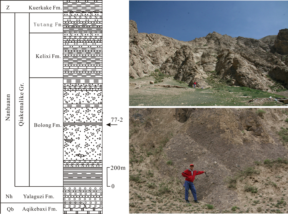
Tieklik region (SW Tarim Basin). The name Qiakmakelik Gr derived from the Qiakmakelik Fm named by Ma Shipeng et al. in 1979, and renamed as the Qiakmakelik Gr in 1989. The typical section is situated in Qiakmakelik valley west of the Xinjiang-Tibet Road on North Slope of Kunlun Mountain south of Yecheng County, Xinjiang Weiwuerzhu Zizhiqu (Xinjiang Uygur Autonomous Region). Coordinate: 77°02′00″E, 36°40′00″N
Synonym: (恰克马克力克群)
Lithology and Thickness
The Qiakmakelik Gr consists of two glacial units and an interglacial unit. The Bolong Fm, the lower tillite glacial unit, is composed of varvite, siliceous mudstone (lower part), diamictite and massive kame moraine, and bearing dropstones in varvite. The Kelixi Fm (inter-glacial) is feldspathic sandstone, conglomerate and quartzose sandstone, its basal part is varvite. The Yutang Fm is the upper tillite unit composed of diamictite and feldspathic sandstone. The Qiakmakelik Group has a thickness of 1702.3 m
[Figure: The Stratigraphic column of the Qiakmakelik Gr and tillite photo in fieldwork in Qiakmakelik valley]
Relationships and Distribution
Lower contact
The Qiakmakelik Gr rests disconformably on the underlying Nanhuan Yalaguz Fm (upper formation of the Sukuluok Gr)
Upper contact
The upper part is disconformably overlain by the Sinian Kurkak Fm (overlapping).
Regional extent
Tieklik region (SW Tarim Basin). It is distributed in the north slope of west Kunlun Mountain, from the Halastan River on the west, eastward to Kurkak, Kzisuhumu then to Qiakmakelik and Kelixi valley, finally to Sumalan area.
GeoJSON
Fossils
Age
Depositional setting
Additional Information